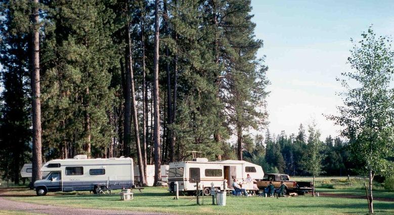
It’s a fantastic time to be an RV adventurer! Technology has given us so many great options for mapping out routes, pinpointing fun things to do along the way, and finding and reserving campsites. FMCA makes RV trip planning a breeze!
There’s no better time than now to plan your next road trip. FMCA has gathered a few ideas to help you get started:
RV Trip Planing Resource #1: RV Trip Wizard
Many RVers turn to RV Trip Wizard for their RV trip planning needs. With 17,000 campgrounds and 57,000 points of interest in its database, RV Trip Wizard provides plenty of options along your chosen route. This web-based platform can be used on a desktop computer, smartphone, or tablet. Users pay $39 per year for access to the program.
Other RV Trip Wizard features include a visual trip planner that allows you to see the route you are taking; trip cost estimations, including fuel and campground fees; and the ability to set driving times and distances. Trips can be exported to Google Maps or to your GPS. With RV Park Reviews as a partner, RV Trip Wizard provides users access to feedback from fellow RVers about campgrounds.
#2: Roadtrippers
Roadtrippers.com offers a fun way to plan a trip and locate interesting places along the way. The web-based program is free, but the Roadtrippers Pro version, which offers even more features and options, as well as an ad-free experience, is due to launch in May 2018 and will cost $79 per year. At this writing, though, a special offer of $29 was available on the website.
While planning an excursion via Roadtrippers.com, RVers can search for camping and RV parks; attractions; food and drink; outdoors and recreation opportunities; services such as fuel stops; shopping; sports; entertainment/nightlife; and more.
#3: FMCA Roadside Rescue®
A trip routing service comes with FMCA’s Roadside Rescue® plan. Of course, the key component of this program — offered to FMCA members for just $74 per year — is roadside assistance. The trip routing benefit is icing on the RV cake!
#4: Campground Connection
When exploring campground options, don’t forget about the FMCA Campground Connection, which leads you to FMCA commercial member campgrounds. Many of these campgrounds offer discounts to FMCA families.
#5: Go Camping America
Another campground resource is GoCampingAmerica. This site lists all campgrounds affiliated with ARVC (the National Association of RV Parks and Campgrounds).
#6: Reserve America
Another option for finding and reserving campgrounds, private and public, is ReserveAmerica.com. The website provides access to 290,000 campsites and also offers a camping guide with destination suggestions, tips, recipes, and more.
#7: Recreation.gov
At Recreation.gov, RVers can make reservations at 2,500 federal facilities, including U.S. national parks and national forests. Not only that, but the site offers a wealth of information about RV trip planning ideas, destinations, and activities across the United States, and it includes a trip builder feature.

And all of that’s just the beginning. It seems that sometimes, planning a trip is half the fun!
And we leave you with the wise words of American novelist and poet Jack Kerouac: “There was nowhere to go but everywhere, so just keeping rolling under the stars.”
Planning a big RV trip? Use FMCA’s checklist to ensure your rig is ready to hit the road.


Hi , we are FMCA member number F424260. Proud owners of a 2007 Fleetwood Bounder. Following up on trip planning: We are considering buying a GPS system designed for RV’s. Does anyone have suggestion or experience on these rather expensive items. Today, for the first time, I came across an App for iPhone which is supposedly set up for RV’s. Any experience with CoPilot app?
Regards,
Dave
We have Garmin RV GPSand we think it’s the best. We bought a Magelin RV GPS and it routed us on a road with 8 1/2 foot tunnels (Saw Mill Parkway NY). When we got back from our trip, it went back. That’s after we set up our RV night to 13.5 ‘ hight and 10 ‘ width. The Garmin is ok but there is no option to put in Propane restrictions so it may rout you thru a tunnel with propane restrictions as in the Baltimore tunnel an Rt. 95.
I too had a similar experience with Garmin. I ended up with an instant skylight. I now have a Magellan RV. It s great for other things like their large screen and and forward looking turns and guidance that doesn’t leave you with last minute decisions especially in heavy traffic areas.
We have a Rand McNally RVND 5510 and I would NOT recommend it. It has many nice features like searching POI’s however it has taken us on roads NO RV should be on. Many times it shows me being 20 feet off I-95 or another main highway and telling me to get back to the nearest highway. They encourage you to buy “Lifetime” maps but I don’t want to do that if they are no better than the existing maps. I would look for something else.
Try looking at Garmin RV760 LMT (life time maps-must have) get an add on media card to expand the storage capability. It is designed for the RVing community. I have used it for two years now and find the ability to put in your RV dimensions: height, length, width very valuable in making sure the routes are truly RV safe. You can get the Garmin Express free on your computer which is the avenue to update maps about 1x each year. Garmin also has free software Garmin Basecamp that I use every year to plan out the travel season. But it is not terribly intuitive, and has a steep learning curve. But I have invested the time to learn it and use it every year. Just remember the garmin gps, or phone apps for maps and direction devices for your car are not the same as driving a 40 foot motorhome towing a car!
We have a Garmin RV 760LM that we use with base camp. It is used mostly to plan our stops and towns we want to see. The only issue I have found with All GPS’s is they do not use county roads unless it’s to the place you want to go. Keep in mind that most county roads do not allow over 100″ wide vehicles (legally). I have never had one warn me of a low bridge as well, so check databases for that.
Nothing replaces a good old Atlas, so make sure you have one that is current.
Another great site is “My Sceinic Drives”. It is a free trip planning guide on line and is very good
I tried it today and couldn’t get any roads except interstate highways to show on the map. I also tried to plan a trip to Orlando and had a very difficult time just getting to New Orleans.
OOPS I misspelled Scenic,
The newer version of the models mentioned above is the Garmin RV770. This has a larger edge to edge screen that makes it a little easier to see when traveling. In my opinion, Garmin is the hands down winner when it comes to RV gps systems because of their Basecamp software for your Windows and Mac PC. Basecamp allows you to save favorite places and waypoints and create routes on your PC and then transfer them to your gps device. This is beneficial, especially if planning routes with numerous waypoints. I like to plan where my gas stops will be along my route and include them in the route, thereby eliminating the frustration and guesswork of finding a suitable fuel stop while on the road. I may have 10 or more waypoints along my route and trying to plan all of that out directly on the small gps screen would be slow and tiresome.
I have CoPilot loaded on an IPad. The iPad is mounted in a suction cup holder and attached to my side window. Love the large scree the iPad affords. Once I reach my destination, the iPad becomes my portable wi-fi device. I switched to CoPilot after a pricey Rand McNally GPS had numerous issues, failing me at the in opportune times. The CoPilot software works great and lets you know when updates are ready for download.
I use CoPilot on Android and my wife likes Google Maps. CoPilot (not Truck or RV) gives a one week trial with voice nav and turn-by-turn. After that it still works, just dumber. I liked it well enough to pay, and they occasionally run a discount. One set of maps is ‘included’, more cost extra. Maps do seem to be updated regularly. US maps are about 2GB.
It lets you have different routing profiles for auto, RV, etc, and you can save custom profiles. It understands height and propane restrictions, but not length or weight. I found that no truck stops were included in the POI database.
I find it pretty easy to use. Multipoint trips can be made, and rearranged by dragging in the ‘plan’ view.
Like any GPS, the routing can sometimes make you crazy. I just insert lots of ‘route through here’ points to fix that.
CoPilot works offline, except for traffic info. It’s free to try, and if you pay it works on all ‘your’ devices. I recommend you try it (free, remember) before paying for a dedicated GPS.